|
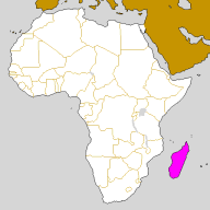
| Madagascar
is an island in the Indian Ocean. It situates at the South of the
equator at 400km at the East coast of Africa. Madagascar is a big
Island; it's the fourth biggest in the world with a surface of 587000km².
From North to South, the Island longs 1580km and from East to West
it longs 580 km. It has 5000km of coast. The climate is kind, even
if there are sometimes cyclones. There are only two seasons: a hot
and wet season from October to April: it's the summer, and the winter
is from May to September, it's more dry and cold. The relief is made
of highlands and mountains in the centre and big beaches on the coast.
Landscapes are also very various from a part of the island to another:
At east and north there are many forests and the weather is most of
the time raining but the west and the south look more dry, like desert
at some places. These two landscapes contrast with the high mountains
of the centre, with its highlands. |
|
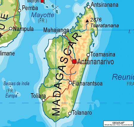
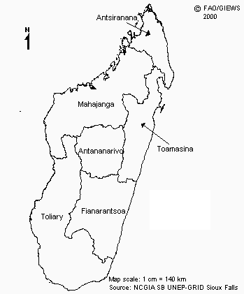
Madagascar
is divided in 6 provinces, the "Faritany": Antananarivo (Tananarive
[European name]) in the centre, Antsiranana (Diego-Suarez) at North,
Mahajanga (Majunga) at West, Toamasina (Tamatave) at East, Fianarantsoa
at South centre, and Toliara (Tuléar) at the extreme South
Each
province has got a big town, which represents one of the six most
important cities there. These big towns are named like the province,
so the big town of Toamasina is Toamasina and so one
The capital
of Madagascar is Antananarivo, it's situates in the centre on the
highlands. It's the most developed town of the Island, it is also
the one that has the most exchanges with the world, even if Toamasina
has the biggest harbour of the Indian Ocean. In the past, Madagascar
was called "The green Island", because of its many woodlands, but
now these woodlands are burned and only spacious ground recovered
by red dust stayed, so Madagascar lost its old name and was called
"The red island".
|
|
Population
The Malagasy
population is around 20 millions of inhabitants and 16 millions
of this live in the capital. This population is divided in 18 ethnic
groups. In the past, each group lived in a definite place with a
petty king to govern each one but actually, since the colonization,
these ethnic groups lived together in the whole Island. A Malagasy
legend told that the ancestors of the Malagasy were some dwarfish
called "Vazimba", but the scientists proved that the Malagasy people
is the result of a big crossing of Arabs, Indians, Syrians, Indonesians
and Africans
These populations came to the island and settle down
in different regions of the country. Little by little, they became
a Malagasy ethnic group after many generations, and then now, each
ethnic group is different of another one from physical signs, heirloom
of the other people. But the division of the Malagasy people don't
stop only at the ethnic groups; each group is divided again in many
castes, for example, the Merina ethnic group counts three castes:
the "Andriana" which are the family of the king, then there is the
"Hova", the nobility and the population who know reading and writing
and at last there is the "Andevo or Mainty" which are the slaves.
Now, even if there isn't kings or slaves anymore, people keep respecting
these castes, so a girl from the "Andriana" caste cannot married
with a boy which is from the "Hova" caste and so one
|
|